Walking the Wyre Way from Dolphinholme to Garstang
Part three: youth
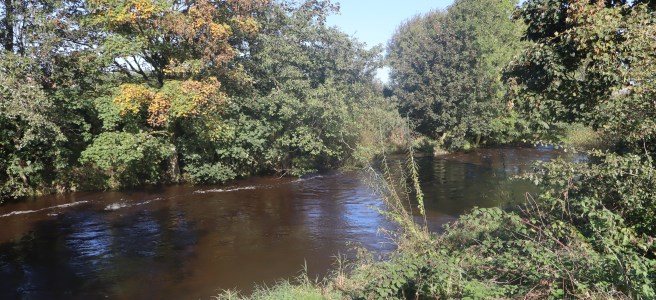
This is where the Wyre begins to exert itself more emphatically. It widens and bulks out – especially after recent rain. It carves a more profound cut into the landscape and there is a stronger impression of the environment emerging from it as opposed to simply accommodating its passage.
The walk
Length: 7 miles (11.2 km)
Time required: 3 hours.
Difficulty: generally easy. No significant climbs, some muddy areas. This route is not suitable for mobility scooters or wheelchairs.
Start: Dolphinholme Bridge LA2 9AU. Some parking is possible on the road near the bridge. More is available on the main road through the village centre (Gleaves Hill Lane). Park near the school LA2 9AN and follow a short path from a few yards west of the school to the bridge. Look for the finger post footpath sign pointing across the road just after the first house.)
Facilities: None at the start but there are public toilets in Scorton opposite St Peter’s Church. Scorton also boasts a couple of good eateries.
Finish: Garstang High Street Car Park. PR3 1WZ
Facilities: Toilets at the car park and several cafes and pubs etc in the village.
You will need
- A map. Ordnance Survey OS Explorer OL41 is the best.
- Appropriate footwear (walking boots or shoes). It can be very wet underfoot in places.
- Appropriate clothing. Including waterproofs.
- Something to drink and some snack food is always a good idea.
Dolphinholme to M6
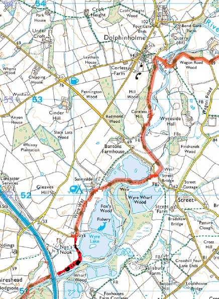
The path from Dolphinholme to Scorton Picnic site is generally well sign posted and mostly level walking.
Leave Wagon Road immediately north of the bridge and take the lower footpath. (The inclined path is the one from the school.) Stay on the path until it leaves the edge of the wood at a gate. Head in the same direction aiming for the left-hand side of the farm buildings.
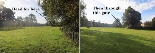
Go through the gate and adhere to the wall on your left to join the drive ahead. Shortly after the delightfully curved keeper’s cottage watch out for a waymarked path on your left as the road bends right. Follow that path.
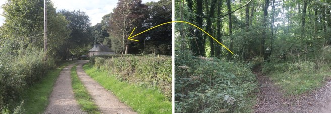
After emerging from the woodland go through a gate and stay close to the river leading to a road bridge over it. Access the road through the gate and go directly across it to pass through a corresponding gate on the other side of the road.
Once again, skirt the field by keeping close to the river. Listen for the building sound of a weir. Just after the weir, leave the field through a kissing gate. Once again, go directly ahead to continue onto the path directly in front of you on the other side of Chipping Road. (You might appreciate a ten-yard diversion to view the weir from the bridge first.)
Keep on the path as it winds through woodland attached to the fishing lakes, which you will soon see on your right.
Your path through the angling facility is well way marked. As you leave the wood, bear left along the main access drive which will take you into the caravan park. Follow the way markers along the slightly curving the drive of the site until you see a kissing gate on your right which you go through.
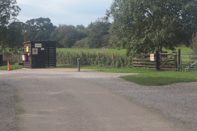
Bear left heading for the buildings of Guy’s Activity Centre (Girl Guide Association). There you will find way markers directing you through the facility. Follow them as they turn you left towards the river.
NB: Older instructions for this walk, and some maps, will direct you to cross the M6 motorway via a footbridge. Do not attempt this. The footbridge is no longer there. The path has been diverted to take you under the motorway alongside the river.
As you pass a line of static caravans on your right keep ahead keeping first the Wyre lake then the river itself on your left until you are guided under the M6 motorway.
M6 to Scorton
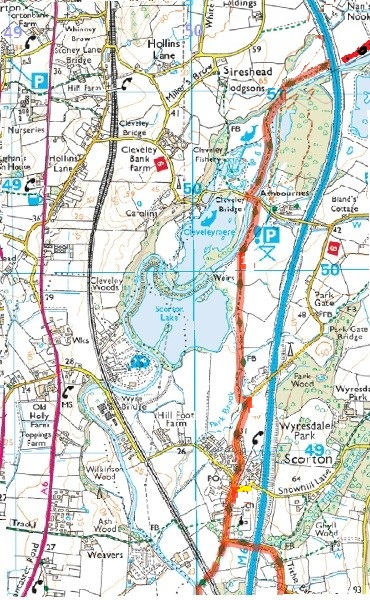
After the underpass stay on the track alongside the river until you reach a road bridge. Cross this bridge.
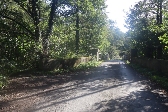
The Scorton picnic site entrance is another twenty yards along the road on the left. There are no facilities other than parking spaces and picnic tables.
Your route continues to the right just after the bridge. Do not be dismayed by the private signs as the footpath is also clearly indicated along the track for about a hundred yards. Just before you reach more private signs on fencing, look for the start of narrow path on your left.
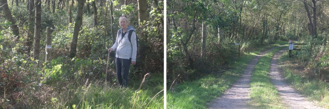
This track hugs tightly to the edge of the woodland before a kissing gate guides you out into the open.
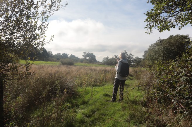
Keep going in the same direction with the field boundaries to your right and the motorway away to your left. These two features slowly converge in the direction of a number of tall trees. Scorton Lake is to your right, and as you get closer to some properties, the path peels you slightly left and over footbridges close to the houses. You will once again be corralled by ‘private’ signs, but the path is always there if you look carefully enough, eventually channelling you between fences.
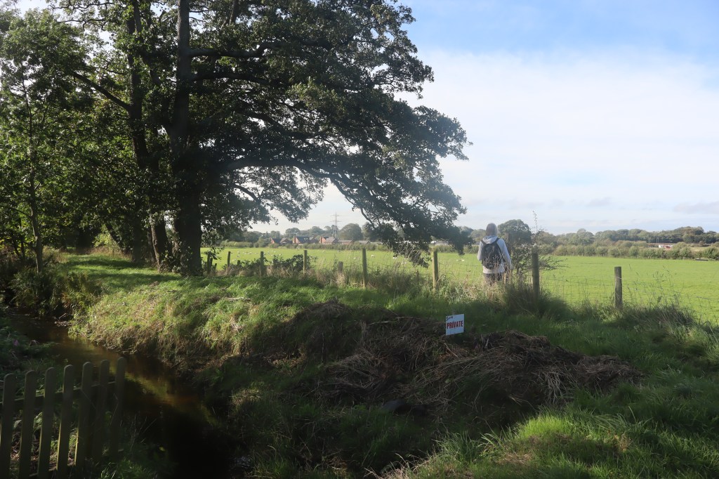
The track leads to a footbridge over the brook and then spills you out onto the Scorton road. Turn right and walk along this road into and right through the village.
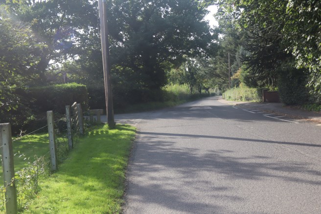
Ignore all footpath signs off to either side. The Wyre Way follows the main north–south road that you are on: Gubberford Lane. After you have passed the public toilets on your right and St. Peter’s Church on the brow of the hill to your left, look for the junction with Tithe Barn Lane. This is one of the places where the Wyre Way splits into alternative routes.
Scorton to Garstang
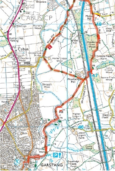
The western route
The more westerly route is very easy to follow. Continue straight ahead along Gubberford Lane. Shortly after passing under the Westy Coast Main Line, the pavement rises a ramp to place you onto the Millenium Way path. This runs parallel to the road has some pleasing views of the river.
When you reach the end of the Millenium way at Gubberford Bridge, do not cross the bridge, but cross the road and walk along Hazelhead Lane for half a mile until you come to Woodacre Hall near the footbridge over the railway where this route joins the eastern alternative.
The eastern route
The more easterly alternative loses sight of the river completely and suffers from the constant moan of the M6 motorway, but it does take you through some pleasant woodland and agricultural fields.
Turn left at the junction pictured above and walk up Tithebarn Lane. After passing a cluster of dwellings lookout for a finger post on your right near a kissing gate. Go through the gate and straight across the field towards the large trees at the left side of the field.
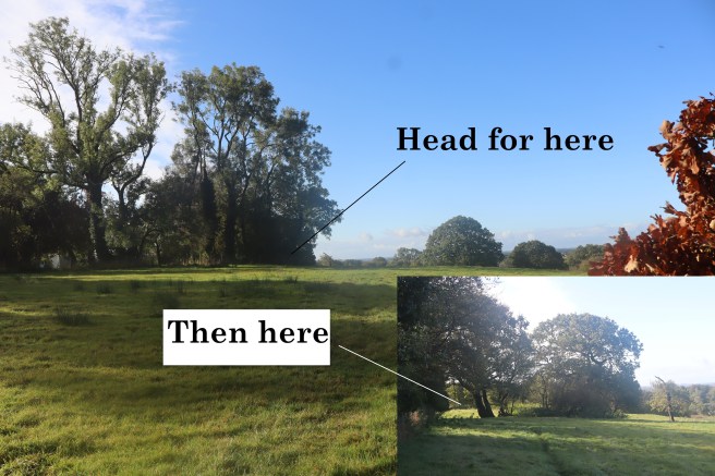
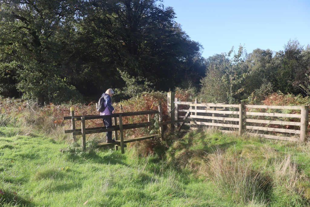
Progress through two more fields keeping close to the left edges, until you come to a waymarked gate at the start of a plantation. This is Woodacre Great Wood. The Wyre Way goes south along the outside the wood until a waymarked footbridge takes you to a gate leading into the wood.
NB: One handrail on this bridge was in need of repair and the bridge itself was a little slippery when we navigated it.
Follow the path through the woods until it ends very close to the M6 motorway. Straight ahead of you is a farm track bridge over the M6 which you need to use to cross it. You can go straight ahead over a foot bridge and up a short but steep bank adjacent to the road, or veer left and go up the more gradual rise to the bridge.
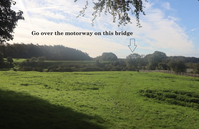
From the motorway bridge you will see a steel footbridge over the railway. Cross that bridge and emerge onto Hazelhead Lane. This is where the westerly and easterly alternatives merge back into one. You will be able to see the path from the railway bridge.
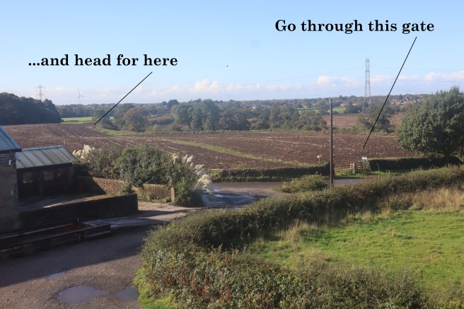
It starts close to the bend in the lane and cuts directly across to field to meet Grizedale Brook which you follow to its confluence with the River Wyre. You then continue along the east bank of the river. Shortly after a smart 1920s aqueduct, take the footbridge over the Wyre to continue along its west bank.
From that point on you simply follow the river south, through the Millenium Park and past the rugby and cricket fields to the car park at Garstang.
Between the rugby and cricket pitches you will notice the substantial floodgates in the river bearing testament its potential power. The Wyre really has grown up. If, like Marion and I, you have followed this river from the start, you will have witnessed roughly one third of its progress through Lancashire.


