Walking the Wyre Way
The Wyre
The River Wyre is Lancashire’s longest watercourse. The mighty Lune and roaring Ribble begin beyond our county boundary, but the Wyre starts and ends entirely within lovely Lancashire. It arises from the Bowland moors to form two roughly parallel tributaries that merge at the village of Abbeystead. From there it winds westwards and southerly then west again before streaming northwards through tidal waters to flow into Morcambe Bay. Its estuary can be seen from its source, as will be demonstrated during this walk, if atmospheric conditions are favourable.
It is thought that its name may derive from the Celtic word for ‘winding’ or from the Common Brittonic for ‘flowing’.
The river is twenty-eight miles long.
The Wyre Way
The Wyre Way is a long-distance path which accompanies the river. In total it is some forty-five miles long. Marion and I have decided to walk it – gradually. There are several places where the walk is schizophrenic in that it has alternative identities. For example, it traverses both sides of the Abbeystead reservoir and each bank of the river from the Shard Bridge to Fleetwood. We will be making choices.
Several guides are available but all the ones we found followed the river from estuary to source, whereas it was more attractive to us to do it the opposite way which, generally speaking, is all downhill. If it wasn’t, the river wouldn’t work.
Part one: the parent tributaries
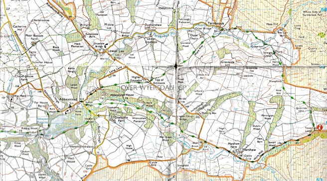
For this walk we found the guide provided by Visit Lancashire[1] very helpful, though in common with many published walks, the distance seems to be underestimated. We tracked ourselves on two different devices using different operating systems with one measuring miles and the other kilometres. Our results tallied so we are confident that our data is accurate.
Walk Details
Length: 7.5 miles (12km)

Time required (senile walking pace): 3-4 hours.

Difficulty: mostly easy. There are a couple of steep sections, but they are not lengthy and briefly arduous rather than hazardous. There are many gates and stiles. This route is not suitable for mobility scooters or wheelchairs.

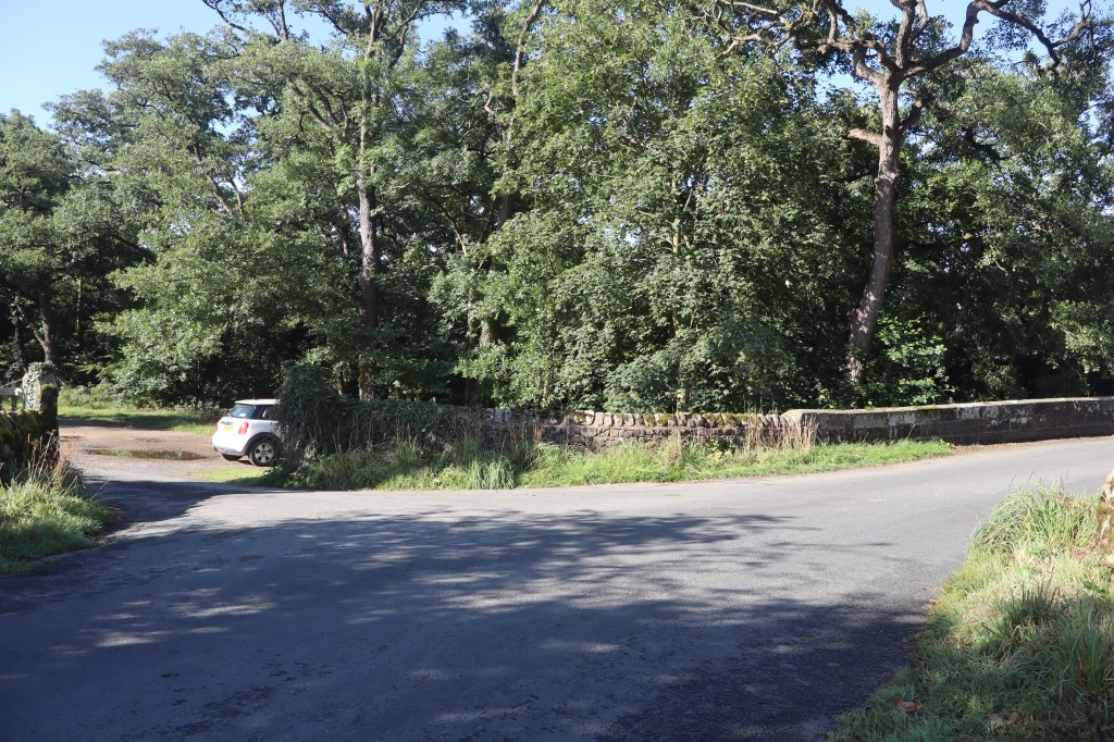
Start & finish: Stoops Bridge Car Park. LA2 9BQ

Facilities: none.

Stoops Bridge Car Park is little more than a layby at the end of Doeholm Rake where it forms a T junction with Strait Lane (the road through Abbeystead) near the bridge. There is room for about a dozen cars. It can get busy at peak times.

There is no charge for parking.
(This walk can be done by overlapping two shorter loops: one of 3.5 miles and the other of 6 miles by using the road between Top of Emmetts and Wells Brook, as will be explained at the end of the text of the route description.)
Note for companions of canines
NB. There is a short length of this walk (300m) during which you are walking on Open Access Land. This is between the hamlet of Tarnbrook and the track entrance to Gilberton Farm. Restrictions for dogs apply. Your dog must be on a lead less than 2m in length to protect ground nesting birds and livestock.

For more details see: Countryside Access rights

Please note that you will encounter exposed livestock throughout this walk.
You will need
- A map. Ordnance Survey OS Explorer OL41 is the best.
- Appropriate footwear (walking boots or shoes). We walked this route in August after the driest July on record but under different conditions it will be very wet underfoot in places.
- Appropriate clothing. Including waterproofs.
- Something to drink, plus food if you wish, and emergency snacks in case of unforeseen setbacks. (You will be some distance away from quick assistance.)
Also recommended
A compass to correctly orientate your map and you.
A pair of binoculars to survey the way ahead.
A mobile phone. (Signal coverage patchy at times.)
The walk
Leave the car park by turning right from Doeholm Rake onto Strait Lane to start the walk with a steep (20%) climb curving past the property at the entrance to Abbeystead House. This is the steepest stretch of the entire walk. Stay on the road for about one third of a mile until it bends sharply left at a cottage with a white double gate. Go through this gate.
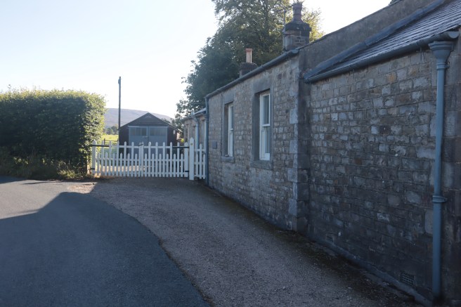
It is slightly unsettling to find oneself in what seems to be someone’s garden, but you exit via a gate after only a few yards. Go alongside the garage where you will find your way out. Keep going in the same direction until you are adjacent to a wall enclosing the Abbeystead House grounds on your right-hand side. Keep to the edge of the woodland until it starts to curve away from you. Now you need to continue straight across the field heading for a large tree close to an isolated house.
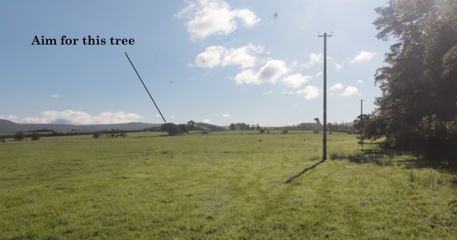
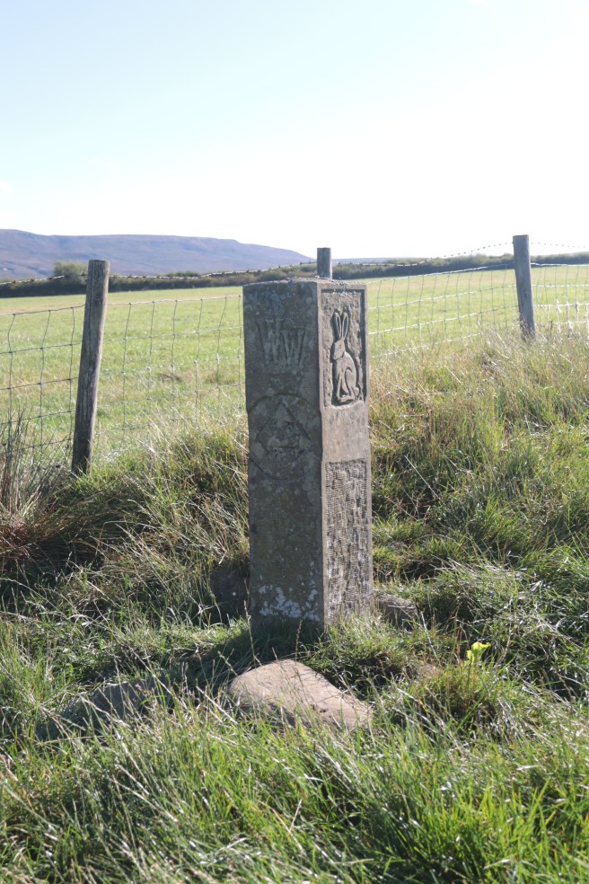
As you get closer to the tree watch out on your left for the first of several stone Wyre Way markers by the fence. These stones are sometimes more reassuring than useful. They confirm you are on the correct path but tend to be in the middle of straight sections and hence don’t indicate turns.
Go over the stile under the large tree just ahead of you then head towards the house (Higher Emmetts), to go through a kissing gate and over a stile in the far hedge to return you to the road.
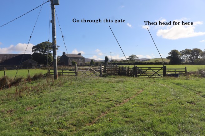
Once there you will have walked just under a mile. Go straight across the road onto the track opposite.
Walk along the farm track. Just before the property, cross the ladder stile on your right. Keep close to the hedge on your left until you find a footbridge and stile in the corner of the field. Now keep the hedge on your right and discover two stiles and a footbridge just around the corner. Cross these.
Your path is now diagonally across the fields before you, crossing another two stiles and a footbridge. Weather permitting, there will be two barns in your field of view, one more or less directly ahead and halfway up a hill, and the other to your left at your level. The latter barn is your target. Aim to pass between that barn and the trees just beyond it. There are two Wyre Way stones along this stretch, the first on your left etched with a bird, the second on your right as you pass the barn, bearing the carving of a hat.
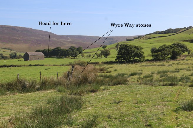
After passing the barn, keeping the field boundary to your right you will find a stile in the corner of the field. Go over that and keep the field edge on your right to find a VERY narrow gate onto a farm track with an equally constricting gate opposite. Persons of a generous girth may find these portals problematic, but both have to be negotiated.
Keep walking straight ahead (at roughly ninety degrees to the farm track you have just crossed) to climb a ladder stile at the first field boundary and stone steps in the wall at the second. You are now alongside the Tarnbrook Wyre. Take a moment to savour its loveliness.
Stick to the slightly higher ground to find a stile that leads to a footbridge over the river. Follow the obvious walled way into the hamlet of Tarnbook, turning right onto the road. Where the road comes to an end you will see a gated track to your left close to a well-weathered signpost to Tower Lodge indicating your route. If the signpost has rotted away, there may still be an access noticeboard by the gate.
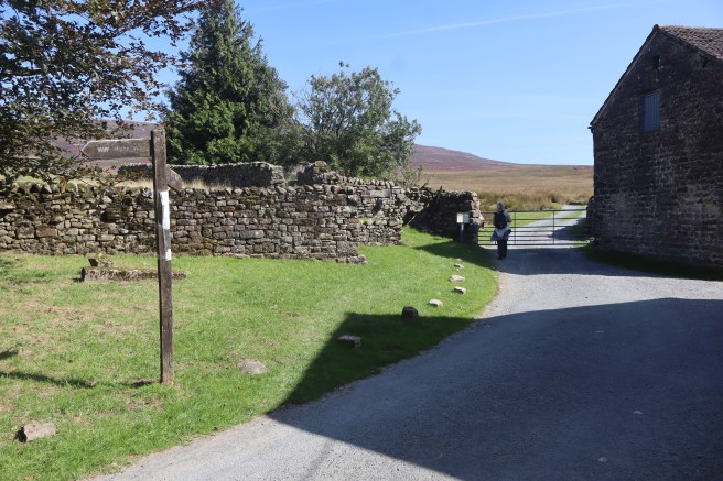
Go through the gate onto a broad track into the moors. (You are now on Open Access Land.) After about three hundred yards you will find a cattle grid at the start of the access track to the farm you can see on your right. Take this track to Gilberton Farm until it reaches the Tarnbrook Wyre just before the farmhouse. Here you will see a footbridge to your left. Cross this bridge and say farewell to the tributary which you will not see again until the end of this walk. This is the closest you will get to the Tarnbrook source of the Wyre, which is some five kilometres (3 miles) away to your left (north eastwards).
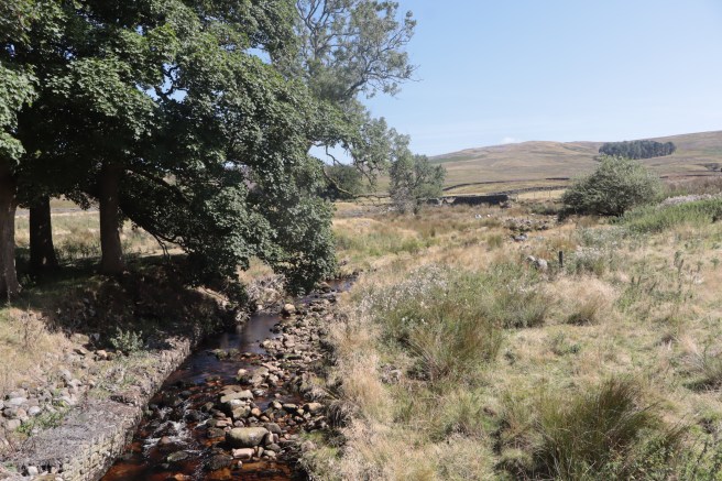
Keep the farm on your right and follow the wall to cross a concrete bridge near a gate. Continue to the disused (and slightly spooky) farm buildings Spreight Clough ahead of you. Pass between these buildings. The ground here was spongy underfoot, and I suspect that in normal Lancashire weather conditions, the mud could be bothersome.
Exit via the gate to the right then bear left up a steady climb. Keep close to the wall and treeline on your left, climbing all the way and over a stone stepped stile in a wall. Head straight ahead for a gate on the crest of the hill. After going through that gate, you will find another WW stone and see a ladder stile on your left which you should ignore, and head instead for one further away and slightly to the right in front of you.
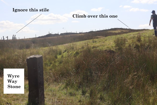
That stile is the highest point on this walk and as you approach it, savour any view you may have to your right (westwards). On a fine day, from close to the source of the River Wyre, you will see Morcambe bay, where it ultimately ends. Cross the metal ladder stile and continue on the same heading to find another ladder stile and then a stone step stile about halfway along the wall.
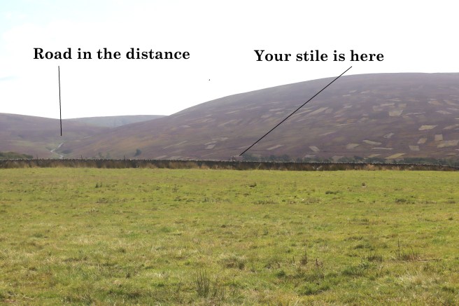
Once over that, continue downhill heading towards the left end of the woodland in front of you. Cross a stile in the fence and move into a plantation.
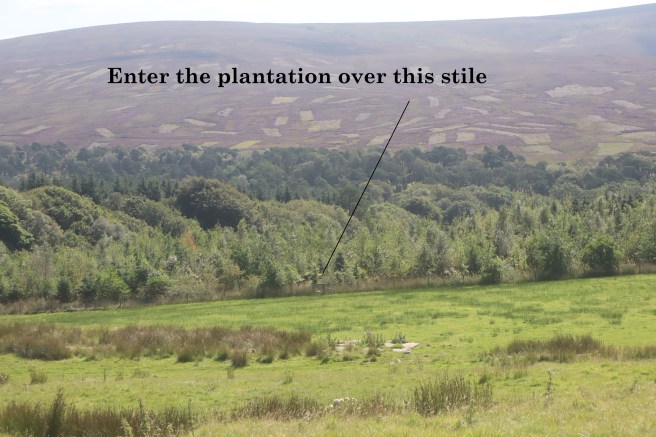
Here the undergrowth is quite dense, and you may not be able to discern a definite path. Go directly ahead and keep descending. A wide and well-used access track is ahead of you and slightly to your left. If you are on the intended path, a way marker post kinks you left to where a substantial signpost puts you onto the main access track downhill to Tower Lodge. For the next mile and a half, you can’t go wrong.
As you begin your descent on the Tower Lodge track, away to your left lies the ruin of Wyresdale Tower, but you will not see that without making a diversion. Follow the track to the charming Tower Lodge gatehouse and turn right onto the road towards Abbeystead. Here you join the other parent tributary: the Marshaw Wyre. As you walk westwards, the origin of this flow is high in the moors behind you, not far from the source of its Tarnbrook sibling.
The Wyre Way now follows the road. You can mostly walk between the road and the river and there are several places to sit by the flow and take a break. It is a bucolically beautiful watercourse.
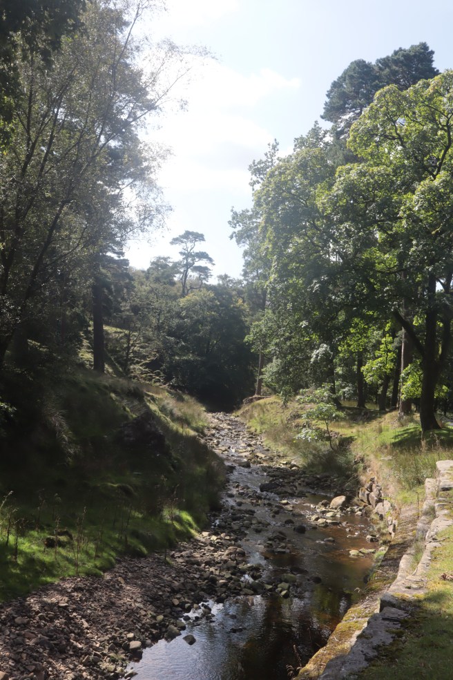
Eventually, you will reach a cattle grid and here a discretionary path allows you to stay off the road for about another five hundred yards. You must rejoin the road via a kissing gate beneath the trees, when the river kinks away to your left. Ahead of you is the road sign pointing down the Cam Brow turn off to Scorton. Keep straight on for another hundred yards to where the road bends sharply right. Here you leave the road for the final time by continuing straight ahead.
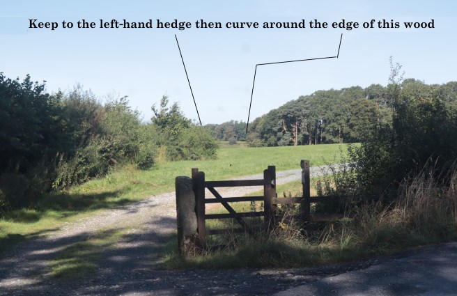
Do not follow the drive but keep close to the left-hand hedge. From here until the end of the walk the path varies from indistinct to invisible. Just before you reach the prominent woodland on the right you can find another WW carved stone way marker on your left, but this is misleading as it points directly ahead, whereas you need to veer strongly right and follow the edge of the wood. Do not be tempted by a footbridge you may see at the end of a stone wall which lies directly ahead of the marker but keep tight to the woodland on your right until your way dips down to a footbridge tucked in the corner.
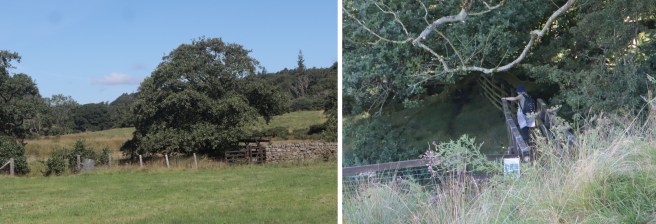
You have not crossed the Marshaw Wyre but a small tributary of it. Continue following the path which skirts a bank where the fencing has fallen away into the river, so take care. You will then come to a footbridge over the Marshaw Wyre putting it on your right where you should keep it until almost the end of this walk. The path is not always apparent, but you are essentially following the course of the river which you will hear more than see, generally about a hundred yards to your right. Whenever your way seems blocked there will always be a stile or gate so keep your eyes open for those.
Keep walking westwards. Ignore a footbridge you may see crossing back over the river in the trees on your right. Close to there you will find a stile over a wire fence that is tucked in a corner on your left.
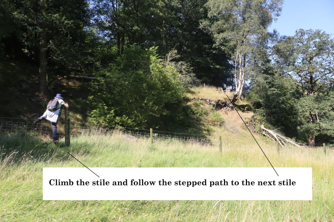
Enjoy the wander through the meadows alongside the final reaches of the Marshaw Wyre. Keep looking into the trees on the far side of the river and you will eventually see the chimneys and gables of Abbeystead House. Very soon after that, the Marshaw Wyre will curve round to cross your path beneath another wooden footbridge. After using this bridge, you are now back between the two parent tributaries of the Wyre and less than ten minutes from the car park. Veer slightly left to find the kissing gate onto Doeholm Rake. Stoops Bridge is fifty yards to the right.
Due to our dwindling rambling stamina reserves, we decided to cut this walk into two shorter loops. If you want to do the same, do not cross the road at Top of Emmetts, but turn right and walk along it for one mile until it bends through ninety degrees to the left at Well Brook, just before the junction with the road to Scorton. On that bend you can pick up the path for the final mile and a half back to Abbystead as described. This results in a three and a half mile walk for the first outing.
You can then do the remaining loop on another occasion by parking somewhere between Tower Lodge and Cam Brow and circling clockwise. There are several places where picnic-makers pull off the road. This is a six-mile walk.
Remember, if you opt for two walks, that the one-mile stretch of the road between Emmetts and Well Brook has been factored into each of these two expedition distances but is not part of the Wyre Way, and hence not included in the total distance recorded at the start of this post.


One thought on “Unravelling the Wyre”