
A ramble through tumbled trees
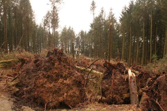
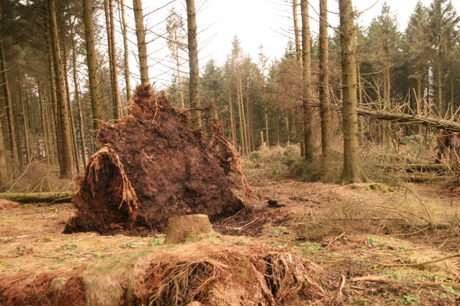
The so-cold ‘Beast from the East’ has left its mark on the woods of Beacon Fell. That bitter airflow, along with recent storms, has toppled a number of trees that crown the much-loved Lancashire landmark. The culling was by airborne natural selection, with the easterly wind finding weaknesses and slicing strips through the plantations. The landscape somehow funnelled the invisible blade, and the collateral damage looks to have been compounded by the domino effect of trees truncating their neighbours. There are individual victims here and there, but in some places coherent corridors have been created. On the grand scale of things these are mere scratches on the surface of the planet, but close up their randomness is enthralling and the thought of being on the wrong side when it happened, somewhat scary.
The best path for seeing a selection of the fallen is to follow the way-marked blue route from the right cheek of the Orme Sight sculpture which is situated adjacent to the Visitor Centre at the Fell House car park. (Small fee – but other free car parks are available nearby.) Follow the blue route and very soon after the first bend you’ll see horizontal victims.
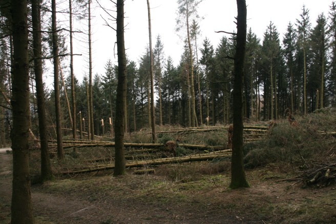
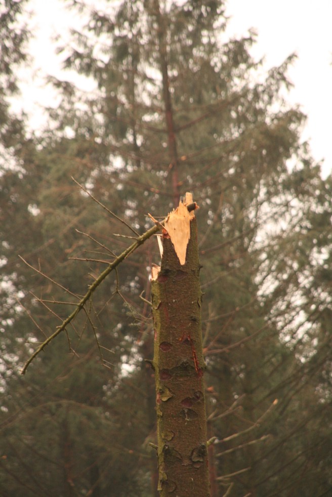
Some of these appeared to have crashed down onto the Starling Wood car park and a section of the fell-top circular road. Note also, the tree trunks snapped like pencils. Presumably this was either the wind finding a weakness in the shaft or, more likely, the impact of their tumbling neighbours. It makes a curious sight.
Where the road and public pathways were blocked they have now been cleared of timbered timber, but warning signs remain, exhorting caution. Some trees may still be unstable and others rest disconcertingly against their upright compatriots.

You’ll find many more examples around the fell, and by following the blue route and keeping your eyes open, you will be provided with a good selection. The full circuit will take just under an hour at casual pace and also afford you a general tour of the popular country park, including at least four of the several sculptures made from natural materials.

Beacon Fell is a modest, but geographically useful landmark, close to the heart of Lancashire. It was one of the first designated country parks in England, and has been open in that capacity since 1970.
The fell is lower than the nearby Bowland hills, and Longridge Fell, but its isolation made it an obvious choice for a place of observation and warning. The earliest recorded beacon on the summit was over a thousand years ago, but it is probable that festive fires burned there long before that. It was one of the chain of beacon sites used to warn of the Spanish Armada in 1588. In modern times, a beacon has been kindled there to celebrate coronations and jubilees.
You cannot get lost on top of the fell, because you simply need to walk down hill and you will very soon hit the halo road. The landmark is also hugely useful when navigating the rural landscape north of Preston between the rivers Brock, Hodder and Ribble, as its combination of height, shape and conifer toupee are easy to recognise.
It’s elevated to 266m (873ft) but easily accessible by car and thoughtfully laid out to accommodate families, and persons of differing levels of mobility. The blue route is not suitable for wheelchairs along most of its length, and varies in the quality of ground underfoot but, generally, it is relatively easy walking with sensible footwear.
Although the most recent falls are the most dramatically visible, there are also a number of other sites on the fell that underwent similar scourges in recent years. Evidently the damage is partly a consequence of the height of the trees combined with the fact that the geology on which they sit is topped by thin, wet soil. Certainly, the fallen vegetation show root systems that seem relatively flat for trees of such stature.
Lancashire County Council have obtained agreement from the Forestry Commission to clear the affected areas and replant them with a wider diversity of woodland, thus improving on the flawed foresight of forty years ago, when the trend was to concentrate on quick-growing conifers. This is good news, as some sections of the site have an atmospherically dense dressing of tall trunks flaunting a Scandinavian-like canopy, but which support a relatively restricted selection of flora and fauna. Mixing the tree species should improve the ecological balance.

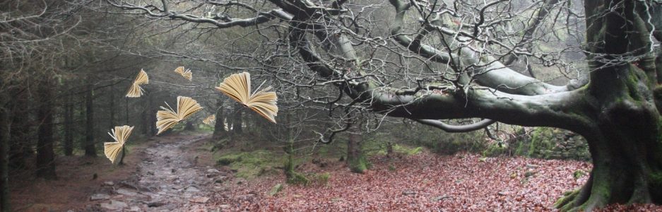
This part of Lancashire is little-known outside of the county, yet it contains some of the prettiest examples of rural England. The views from Beacon Fell are elevating and the footpaths life-enhancing. The walks switch between the open and the enclosed in swift succession weaving their particular brand of cosy, but wild, enchantment.
Influenced
Beacon fell overlooks the valley of the river Brock, and presents aspects of the Bleasdale Fells and Longridge Fell all of which feature in The View from Jefffey in The Atheist’s Prayer Book .
The Walk
![]()
Start at the Visitor Ventre: PR3 2NL is the quoted postcode but this is not precise, taking you instead to a location on one of the approach roads, however once you are on the one-way circular hilltop road you will eventually come to it! The Visitor Centre is on the western quadrant of the hilltop road (Beacon Fell Road).
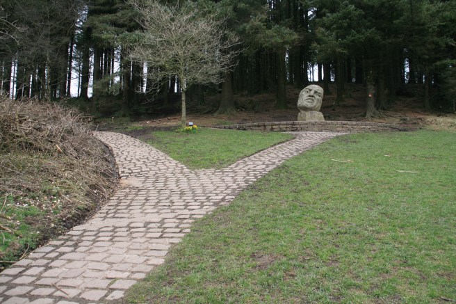
When at the Visitor Centre, walk uphill by the café and veer left past the Orme Sight sculpture. Follow the blue way markers.
Be careful at the Lizard Love Seat (always good advice!) because the signs are a little confusing with blue markers in two directions.
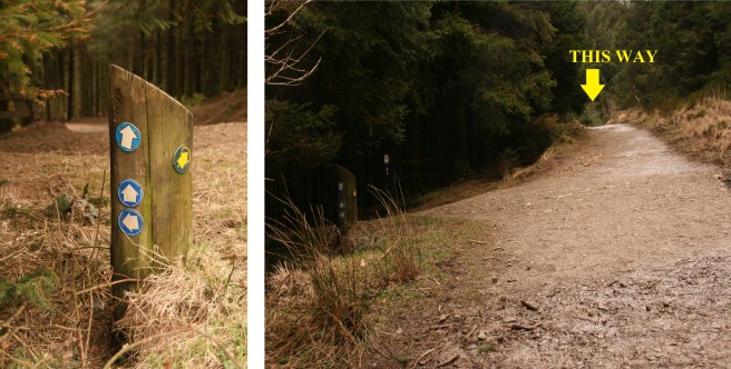
Keep straight on. (The left-hand path takes you down to the road.) A few hundred yards further you will come to anther fork.
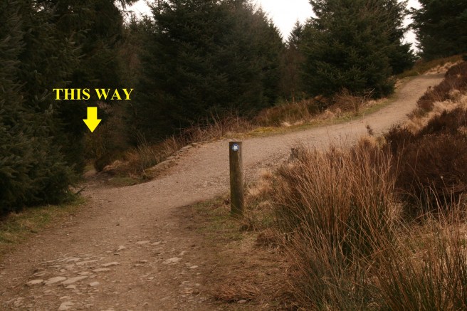
Veer left here.
The rest of the route is easy to follow if you keep your eyes skinned for the way markers.

When you are four-fifths of the way around it is worth taking a small diversion to the summit. Watch out for the wooden owl.
Turn right just after the owl and it’s about a hundred yards to the top.
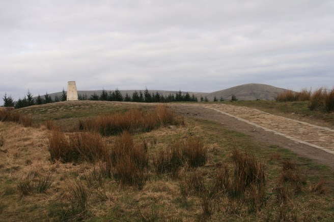
The brass plate on the triangulation pillar indicates distances to view points, some of which can no longer be seen due to the growth of trees since the plate was installed. Retrace your steps to the junction where you left the owl and turn right to put you back on the blue track, or you can stay on the yellow route (The Summit Trail) – both ways lead back to the Visitor Centre. The yellow route will take you past the walking snake sculpture, the blue past the kingfisher, but it is easy to miss the latter as it is not marked on the map, though its location – the pond – is.
