
A four mile walk
In 2006 we found the source of the river Ribble and took some pictures. We lost the pictures, and so in 2022 we went back to take some more. If you can get to the nearest point on the B6255 road it is actually only a fifty-minute walk to the source of Lancashire’s longest river.
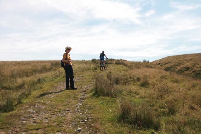
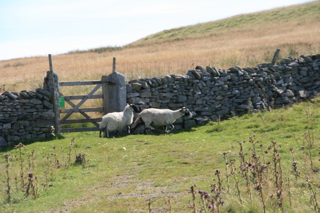
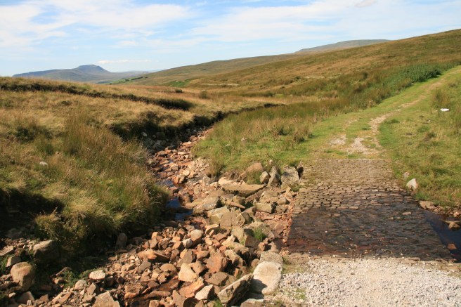
The two-mile trek to the start of a stream called Jam Syke follows a well-defined bridlepath to within a hundred yards or so of the source, which is easy to locate even in a dry summer. The walk to the spring is all uphill, as you would expect, but it is a continuous gentle climb along a relatively shallow gradient.
The Ribble
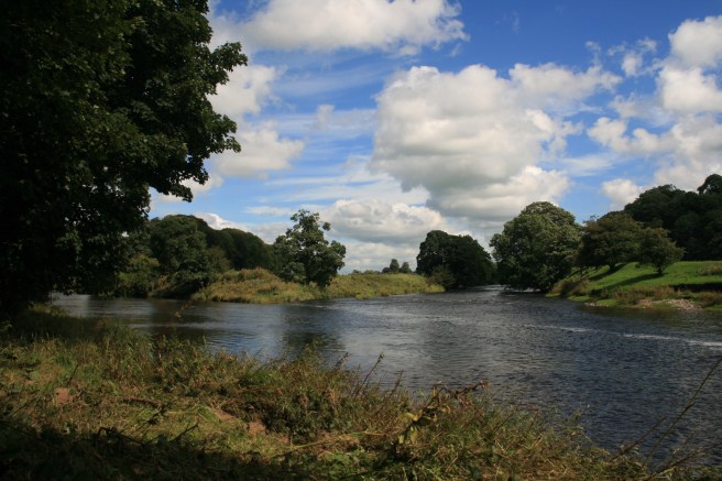
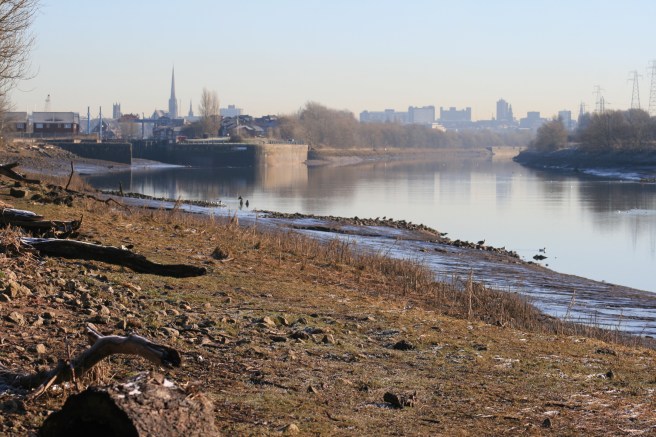
This seventy-five-mile serpent is the only major waterway rising in Yorkshire that dares to slither westwards into Lancashire, before spewing into the Irish Sea from a ten-mile mouth between the incisors of Lytham and the canines of Southport.
The etymology of the name is uncertain but the Oxford Dictionary of Place Names cites the likelihood of it being based on the English (or Anglo Saxon) adjective ripel or ‘tearing’. This, in turn, is thought to derive from Old English ripan ‘to reap’ or ‘to tear’.
To what angle the ancients applied the tear or rip is lost in the folds of time. It may have been the way the river cut through the land, or perhaps it was more to do with seeing it in spate, tearing along. In modern times it presents a mostly sedate motion, but as with all watercourses, it can turn merciless following the fall of heavy or persistent rain on the westward Pennines.
We set out to walk the entire Ribble Way from mouth to source at the start of this century, but by doing it piecemeal rather than in one go. As things turned out, we decided to miss a few sections because, for various reasons, not all of the route clings to the river. The parts that do include some joyous vistas. The Ribble is a beautiful river. It rises on the Pennine moors (in fact the path you follow continues beyond the source to a junction with the Pennine Way) so the panorama – weather permitting – is an open rolling wilderness in the mutual bosom of the Three Peaks of Ingleborough, Whernside and Pen-y-ghent. The distinctive brow of Ingleborough watches over you all the way along this stretch.
The Walk
I never recommend walking in the countryside without a map, but to be honest you really can’t go wrong if you follow these instructions as it is one very-well used bridlepath all the way there and back.
You will need:
- Very sensible footwear (Boots or robust country walking shoes.) Parts of the walk can be slippery and you have to cross a shallow ford of a contributary stream even when the weather has been dry.
- This, or another, route guide.
You may also benefit from:
- Weatherproof clothing. (You are above 1300 feet the whole time and the weather can change very rapidly and very fiercely.)
- An ordnance survey map (1:25000 Ordnance Survey Explorer OL2 covers the whole walk area)
- Refreshments
The start
The route described here starts from the junction of the B6255 and the Newby Head Gate road to Dent and Sedberg.
There are no facilities whatsoever at the start of this walk and that includes car parking spaces. There are a couple of patches that have been worn into makeshift laybys by repeated use, but these only offer space for two or three cars. The road is not busy, but it is in persistent use, including by HGVs so please park considerately and safely.
There are no public transport means of getting to the start, but you could cycle, in fact you can cycle along the bridleway to within sight of the source if you have the right kind of bike and a stone-hardened bum.
The walk starts opposite the Dent road at a very clearly marked gate just 25 yards south of the junction signpost. Simply get on the path and stay on it.


The source
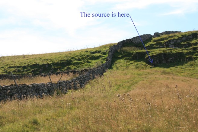
After about three-quarters of an hour, or less if you are younger / fitter than your scribe, you will see a wall slicing across your path. Do not go through the gate. Instead turn right, to leave the bridelpath and follow the wall up the hill towards the crest.
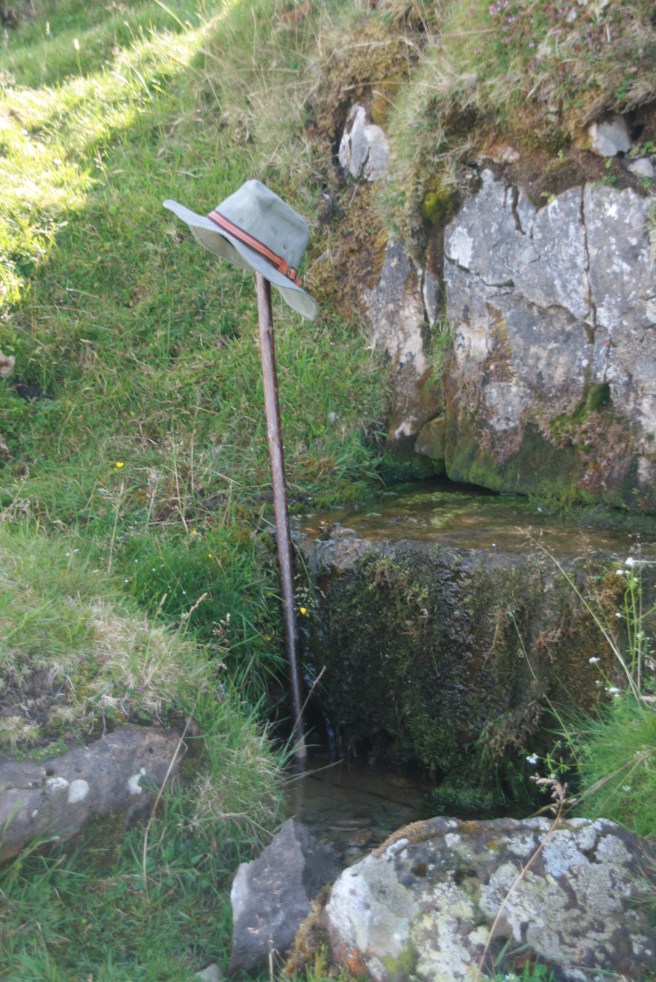
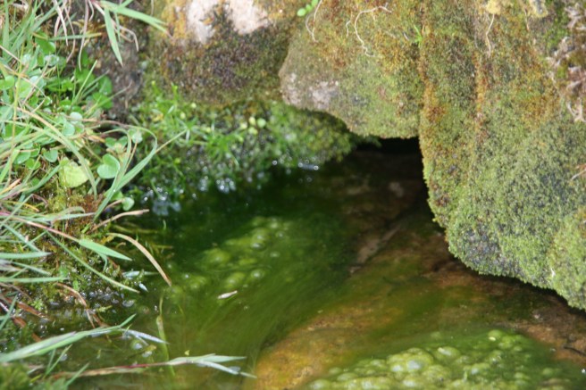
Just to the right of where the wall rises over the visible summit you will see the face of a rocky escarpment. That is where you will find the source.
Other possible sources have been suggested, but this is the one that seems to meet the consensus of modern opinions. There are a number of springs in this area from which the flow will eventually arrive at the Fylde coast after passing Ribchester, but this one is the highest of them.
The return
Simply retrace your steps along the bridleway back to the road.
The duration
My pedometer clocked 6.3km. (4 miles). The full walk took us two hours including a fifteen minute break by the source to take in the view and sip the freshest of spring water.
The source of me
I wondered why the impulse to go back was so strong, but sitting by the start of Jam Syke on Gayle Wold the reason is clear. This was the source of me. My family, along with countless others were nourished in settlements that flourished where they did because of the Ribble. If that river had not been there then I would probably not have existed at all, as the bloodlines that formed me would not have met. This spring caused my origin.
You may consider that to be grandiose nonsense. The river is fed from many other places, but that’s not the point. If ancient geology had forged, folded and eroded differently, the westward flowing water would have torn a different route. Chance decreed that the land would lie as it does, and from that fortuity the flow led to my conception. I am here because the river is here, and it all has to start somewhere. It starts high on Gayle Wold. I know that now. I’ve seen my geological womb. Twice.
Influenced
The river Ribble flows through much of my creative output.


One thought on “The source of all Ribble”